


PNG Surf Report and Forecast December 2023 to January 2024
Papua New Guinea surf report and forecast by Chris Buykx
MAJOR SWELL ALERT!
Papua New Guinea is a surf frontier that is rarely documented. This is a bonus for surfers as the mystery helps keep the crowds away, but its not an issue as the Surfer Management Plan keeps surfer numbers strictly limited.
For surfers with plans to explore the potential of these incredible tropical islands, it’s hard to get an understanding of what makes it work as there is little information online about swells ore recent conditions.
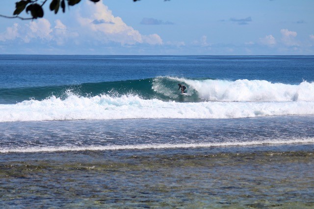
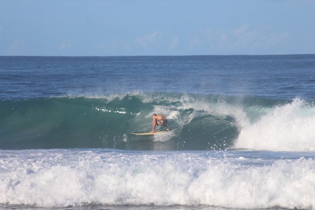
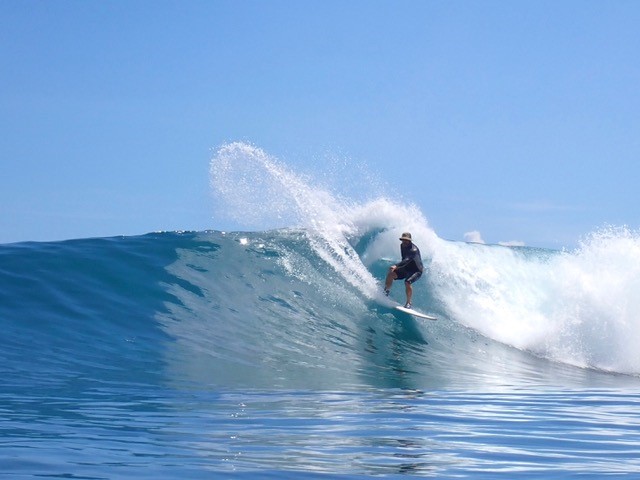
Bulu is a hollow Right near Rubio in New Ireland Province. This is what everyday ENE Trade swells look like, Dec 2023
One way to think of PNG swell systems is that it’s kind of like the Maldives, except it’s the Pacific and flipped to receive swells from the NNW around to the ENE. Like the Maldives, PNG receives both long period groundswells from high latitude storms as well as mid-period trade swells from the tropical trade wind belt. The North- to East-facing coasts of the PNG mainland and New Ireland receive the best of the swells, and with vast North Pacific and deep marine trenches offshore, what appears to be very small swells in a forecast can turn out to be good to epic waves at select reefs.
New Ireland Province is host to Nusa Island Retreat near Kavieng, Rubio Retreat 250km SE of Kavieng and the remote New Hanover region where PNG Explorer charter plies the waves.
This region benefits from North groundswells (14 – 22 seconds) when Pacific Storms dump powder snow on Japan, there is a good chance of a powerful fetch point south to PNG in equatorial latitudes. In these conditions, Picaninny Point at Kavieng can fire up. Yet the everyday surf is mid period (9-12 seconds) from ENE to NE. The swells ebb and pulse with the broader but lower intensity trade wind belt in the lattitudes between Hawaii and the Equator. The advantage of trade swells is that they can be long-lasting, sometimes weeks of swell stretches into months of small to mid-sized surf.
Surf Report December 2023
Rubio Retreat is hosted by Shane Clarke, a keen surfer who despite his remote location loves to share the stoke of the waves he is getting. Shane will send a photo to Perfect Wave most days whether the surf is small or large, so it’s a great barometer of surf conditions.
December 2023 has been blessed with consistent small to mid sized swell and glassy conditions at Rubio, where the the mountains and jungle shelter the breaks from any synoptic winds. However, over the week of 16 – 20 December, this pulsed with a strengthening of the NE fetch in trade wind field resulting in well-overhead waves at some of the premium breaks near Rubio.
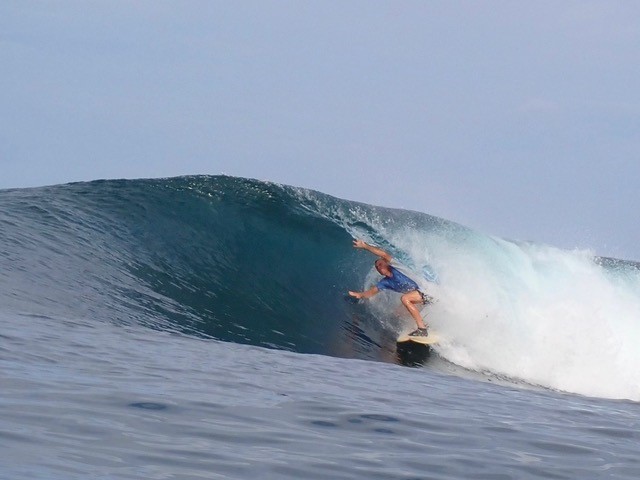
Shane Clarke checking the internal dimensions of the barrels at Rubio, 9 December, mid range trade swell.
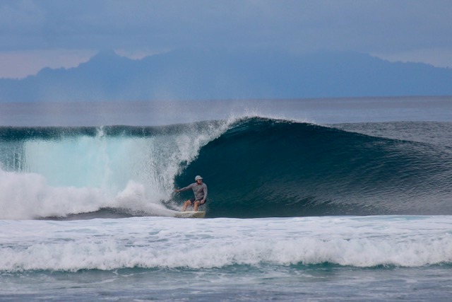
Strong NE trade swell builds to 1.5m @12 seconds on the forecast, hits a little harder at Kanons near Rubio.
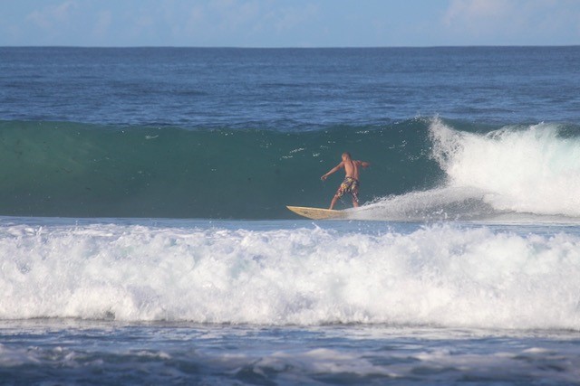
Return to regular programming with sequence of Shane out front on just another December day at Rubio (21 December 2023):
Forecast January 2024
The surface winds across the North Pacific for 23 December show an ideal North Hemi Winter pattern.
ENE Trade winds fetch stretch all the way from the Phillipines to Hawaii and directing 1 – 1.5m of swell at 9 – 11 seconds towards PNG. Vanimo in the West of the PNG Mainland enjoys the longest fetch and should see waves building 3 – 4 foot and holding for the next few weeks.
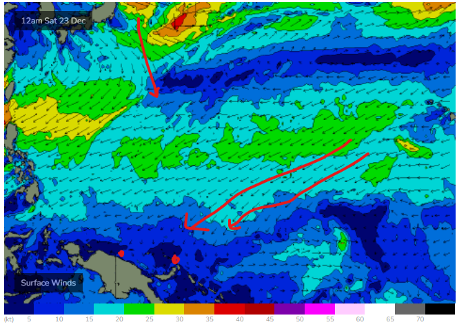
Surface Winds before Christmas show decent Trade Wind fetch between Hawaii and the Equator set to deliver consistent Small to Mid-Range NE Trade swells in to January 24
The first week of January 2024 is the start of an active period in the PNG Swell windows. Storms pushing away from Japan will set up out a small but strong N groundswell due in PNG around the second week of the New Year. This swell won’t be prominent, but some sets will come with extra punch as they interact with the trade swell. This swell will probabaly be overshadowed by a series of NE swells where Low Pressures approaching Hawaii send a strong fetch pointing back towards PNG. The two swells will The pattern will continue into January 2024, with increasing strength in to the 3rd week of January
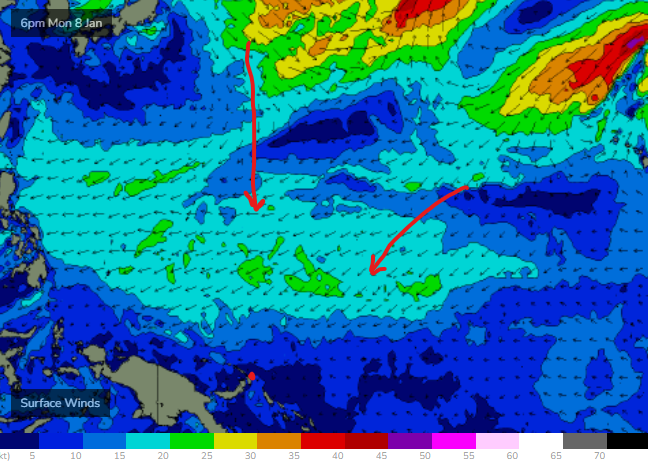
Surface Winds over North Pacific, 8 January 2024, from Swellnet WAMs
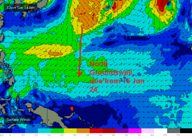
Major round of swell due for PNG MID January. the 3rd week of the month is set to pump!
Swell Alert from 20 January 2024
Any skiers and snowboarders heading to Japan in January are set to score some massive JAPOW days. A series of deep lows crossing from Siberia crossing Honshu and Hokkaido are puking powder non stop through mid January 2024. The good news for surfers is that these storms are then crossing in to the North Pacific and creating intense fetch of strong Northerly winds, building a major swell event due to impact PNG from 20 January 2024.
Initial indications are for a NNW groundswell that will build strongly as the storm traveses slowly east creating a captured fetch, where the storm moves at the same pace as the swell, intensifying wave heights. Current Indications are for NNW groundswell >2metres @ 11 seconds to hit Vanimo in the far west early on the 20th January, building at Vanimo to near 3m @ 12 seconds on the 21st January 2024. This should translate in to double to triple overhead at exposed breaks like Lido Right.
The swell will arrive slightly later in the east, so Kavieng and New Ireland Province will see the swell build through 20th in the range of 2m+ @12 sec N, however swell continues and builds and is not expected to peak untill 22nd January around 3 – 4 metres @16 seconds from Due North. This is probabaly the biggest swell event to hit PNG in over a decade and there is potential for large damaging swells affecting coast and infrastructure.
Premium North facing breaks like Picaninny Point should see the best days of the year on eaither side of the peak of the swell however given the scale of the swell it likely most breaks will be maxed out at times. The good news for surfers is that this swell event has a long tail and high potential for more storms off Japan and more swell in manageble size in to the end of January and February.
There is still availability for some select dates in January, Febuary and March 2024 at Vanimo, Rubio and Nusa Island Retreats.
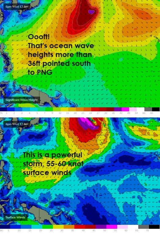
I have marked up the Swellnet WAMs showing wave height and surface winds in NW Pacific forecast for 17 January 2024 allow a few days for the swell to travel to PNG and things should get spicy from 20th Jan onwards, swell peaking 22nd January around the 3-4 metres at 16 seconds, likely the most significant swell in over a decade!
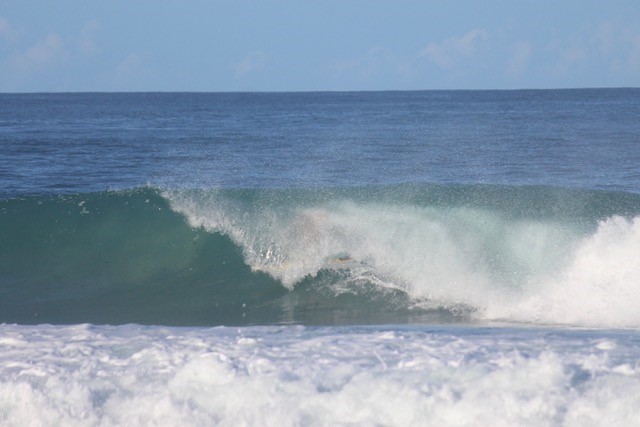
This is what small to mid range NE swell looks like in New Ireland Province PNG
The goldilocks zone! Not Too Big, Not Too Small, Just Right!
 Papua New Guinea Surf Travel