


Big Wednesday Week July 13-20 Sees East Coast Australia On The Pump!
If there’s been a good news story to emerge from crazy ole Covid 2020, it has been that the surfing community have been more focused on … um surfing.
With all the extra time on our hands many of us have been focusing on the simple things like good health, family and staying fit… surfing.
It sure has helped that mother nature has been delivering plenty of swell.
Last week the East Coast of Australia pretty much pumped all week long.
A broad area of low pressure parked itself in the Tasman Sea, initially centred just a couple of hundred Km’s SE of Sydney on Tuesday July 14. The East Coast Low intensified overnight delivering triple overhead bombs on Big Wednesday, before slowly drifted ENE towards the Nth Island of NZ as the week progressed, producing cleaner but still double overhead conditions well into the weekend.
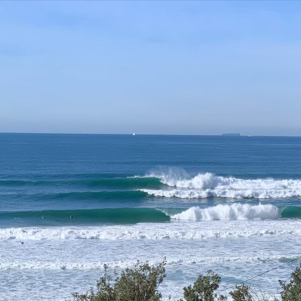
The swell event began on Tuesday morning July 14 with gale force SW to Sth winds combining with a solid 6 to 10ft plus SE swell. By mid afternoon crew were already surfing inside Port Hacking, Botany Bay, Sydney and Newcastle Harbour’s seeking protection from the wind, catching some cleaner 3-4ft novelty waves.
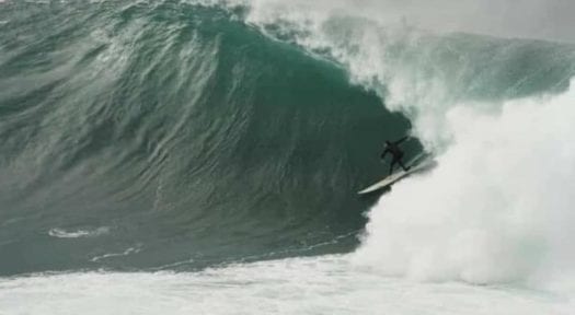
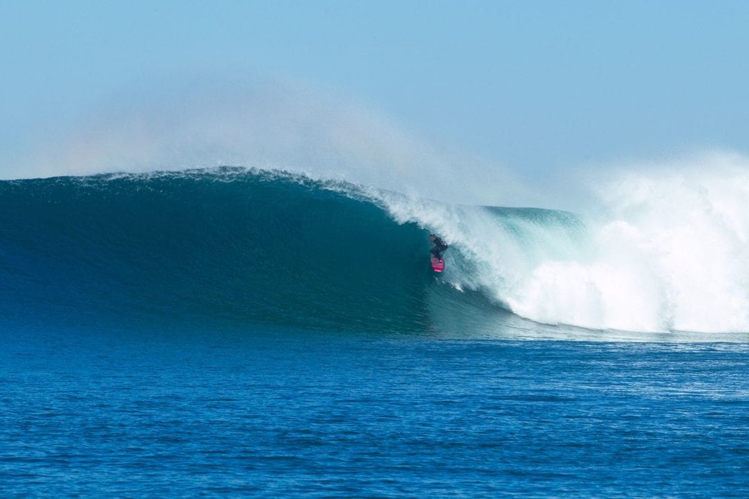
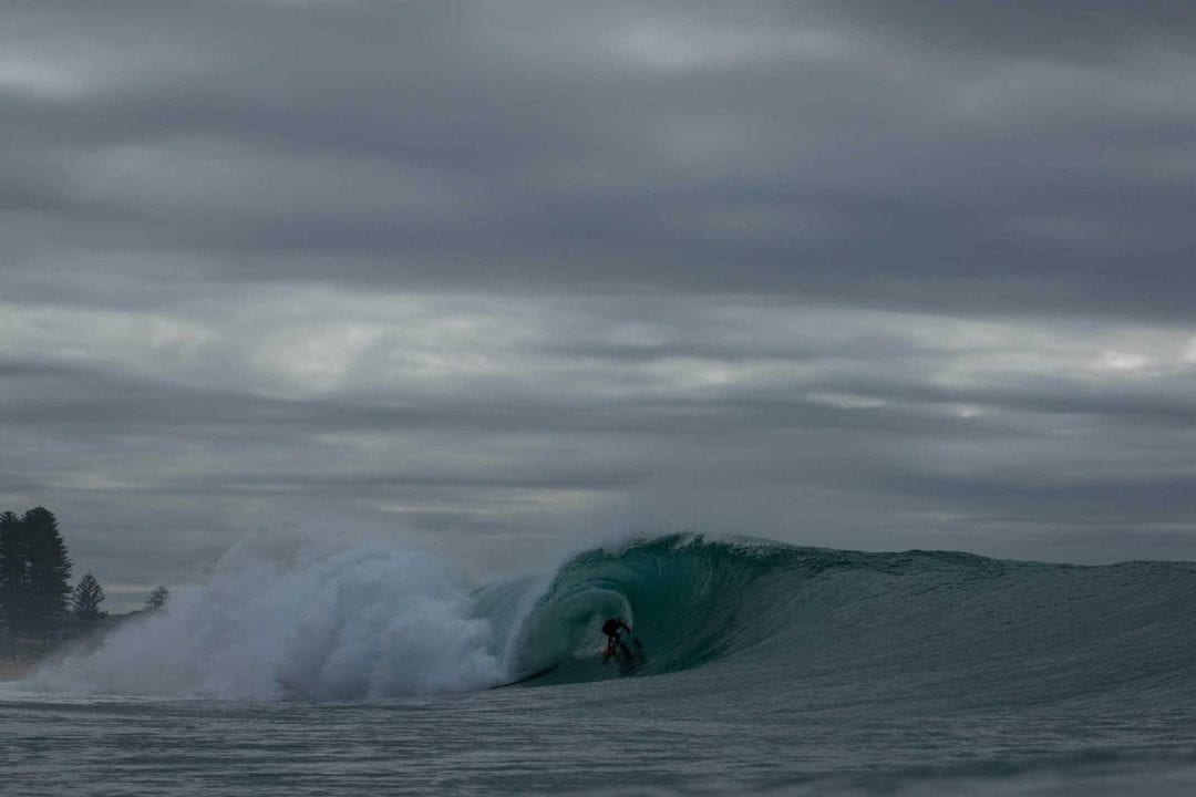
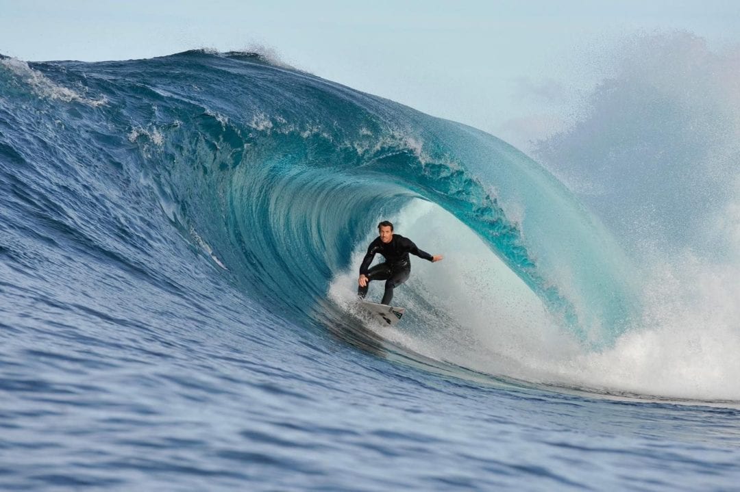
Big Wednesday’s July 15 huge pulse of SSE swell lit up some of Sydney’s traditional big wave proving grounds, places like Cronulla Point, Lurline Bay, Wedding Cake Island, and Deadmans at Fairy Bower delivering 12 to 15 foot plus sets at times.
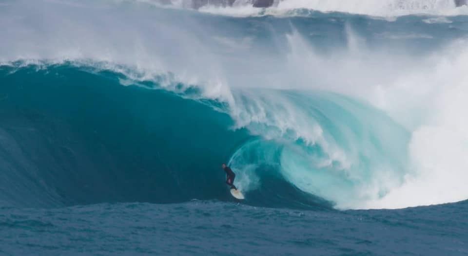
Deadmans dished out some huge barrels for a bunch of core chargers on Tuesday, Wednesday and Thursday. Spencer Frost set up his camera up with 1500mm of zoom from Queenscliff Headland and got the best angle of the day on Big Wednesday.
Deadmans delivered some huge barrels on Big Wednesday July 15. Must watch video highlights by Spencer Frost:
Down south select protected options at Sandon Point and around Shellharbour were smaller and cleaner, whilst north of Sydney from the Central Coast right up to the far Nth coast winds were more favourably offshore and the swell was noticeably cleaner and more manageable.
Across the border into Qld, Snapper, Currumbin and Burleigh lined up nicely, however the wind was a little NNW and up face on Wednesday, but later in the week and into the weekend the wind shifted more W, and eventually SW/S, so Snapper, Lennox and a bunch of other set ups came well into play.
The standout option north of the tweed throughout the week was T.O.S. and some outside rivermouth set ups, but into the weekend Snapper, Burleigh and Currumbin improved as winds turned more SW/S.
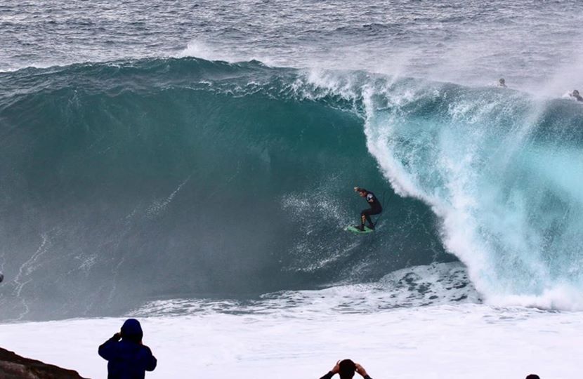
A day after Deadmans and Sydney lit up a cettain offshore set up not far from the Gold Coast was throwing down groomed perfect barrels for a dozen or so crew with skis and some local knowledge.
Not far from the Gold Coast this offshore set up delivered big pits for Brent Dorrington, Sheldon Simkus and friends:
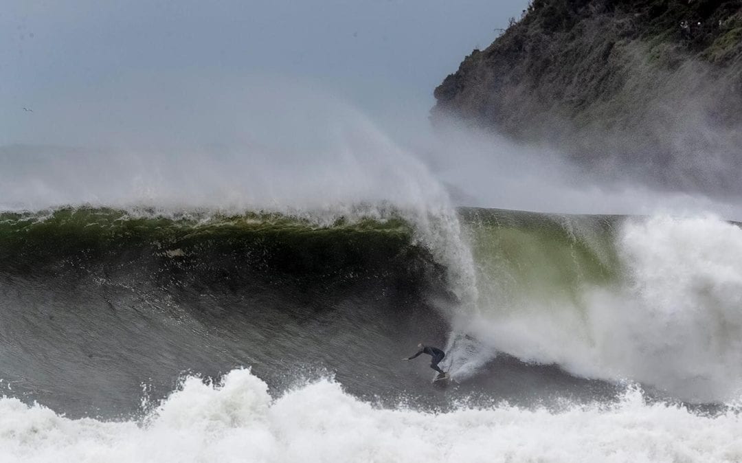
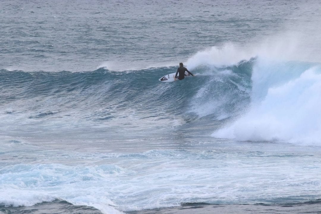
Back in Sydney and surrounds, as the swell slowly started easing on Thursday select beachies like Sth Narrabeen started to come into play. The usual suspects like Matt “Werris” Grainger and The Captain amongst others started spending way too much time behind the curtain. The Captain said, “The swell started twisting more East on Friday, particularly later in the day, delivering some manic, gnarly pipelinesque stand up pits in the 10 to 12ft range.”
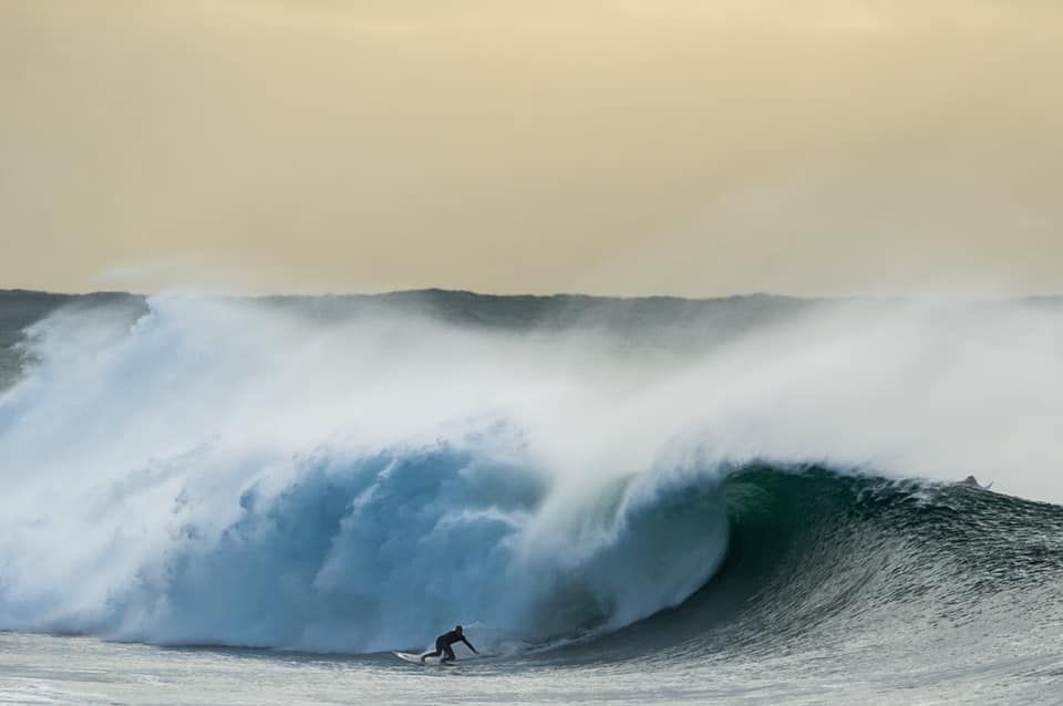
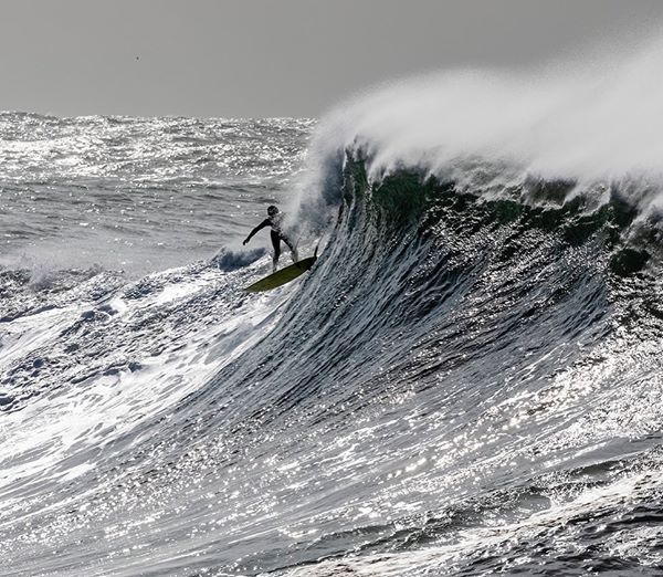
Saturday morning was on the pump with legends past and present charging the super sucky lefts at South Narrabeen. Tom Carroll, Nathan Hedge, Matt Grainger, Jason Gribble, Matt Dunsmore, Braden Porra, Davey Cathels, Ben Dunsmore, Josh Yorke and a bunch of other local chargers were towing and paddling into a hectic line up of stand up pits mixed in with bombing close outs.
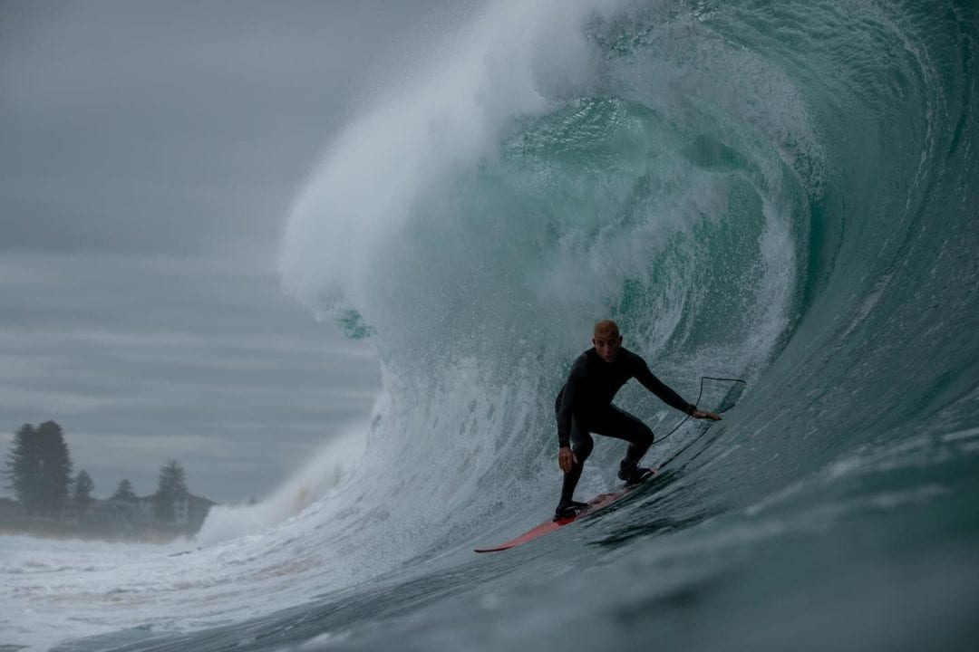
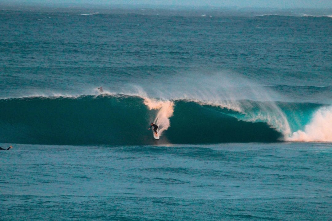
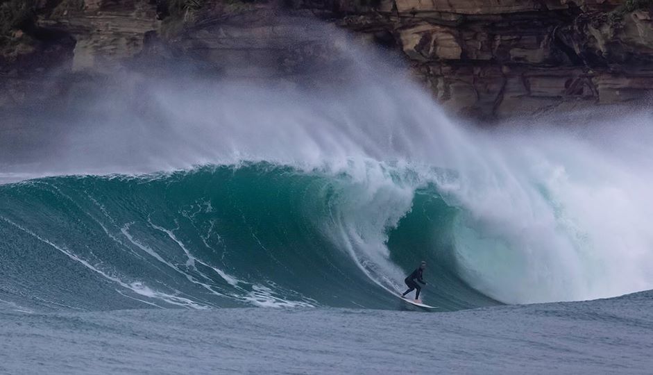
South of the Harbour Bridge the focus was on Cape Solander on Saturday morning.
A core cast of committed slab hunting maniacs were amped as usual. Check world renowned big wave surfer and shaper Dylan Longbottom’s first wave back after being out of the water for 5 weeks with a knee injury below as captured by @1962 Paul.
Coastalwatch’s chief swell forecaster Ben Macartney said, “Wednesday’s peak in mid-period South to SE swell was generated by a 50 knot south to SE fetch wrapping around the storm’s south and southwestern quadrants.”
 More Like This